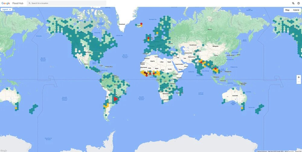
As per Google officials, "AI can play a transformative role" when it comes to staying safe in case of a natural emergency, which is why the company is working on predictions and forecasting technologies, powered by artificial intelligence.
Some of the most common natural disasters that kills thousands every year and disrupting the life of millions, floods are one type of event that Google started researching since 2018. Thus, company experts started working on an AI-based forecasting tool, which uses geospatial data to provide real-time flooding information for different regions on our planet.
The coverage of the service has been extended to 80 more countries in 2023, providing 460 million people in Africa, Asia-Pacific and European, among other regions, with forecasting information up to seven days in advance.
The service has been actively used in August to help people and authorities in Chile prepare for the floods that happened in the country.
Wildfires are also another type of dangerous natural phenomenon, one that's more common now than ever before. Google's AI-based SOS service for wildfire warnings, which is continuously being developed, warned over 30 million people this year about 120 wildfire events in their areas, helping them prepare in advance.
Using AI and satellite images, the wildfire tracking software developed by the American company provides near real-time information on the evolution of wildfires, as it updates every 15 minutes.
Currently, the service is being available on Google Maps and Google Search in fire-prone areas in the US, Canada, Mexico and Australia, but coverage will be extended soon, as per the representatives.
Heatwaves are also becoming almost synonymous with the summer season, which is why Google launched extreme heat alters in 2023. Thus, "when people search for information on extreme heat, they see details about when a heat wave is predicted to start and end, tips on staying cool and related health concerns to be aware of from the Global Heat Health Information Network (GHHIN)", Google officials explained.
Citizens in over 80 countries around the world benefited from information on extreme heat events.
Explore your city in a different way
Google's Tree Canopy tool is another useful and fun-to-use software that combines AI and satellite imagery to assess multiple aspects of a certain city. Recently, the tool has been expanded to 2.000 cities and it helps with checking the tree canopy coverage, estimated transport emissions and even rooftop solar power potential.
For Bucharest, for example, the tree canopy percentage in the city is 29%, covering around 67 square kilometers of the capital city, while transport related emissions for 2022 rose 8% to over 2 million when compared to the year before. Also, the solar roof potential in Romania's capital is about 1.9 million MWh, as per Google's estimates.
Berlin, on the other hand, has 45% of its total surface covered by the canopy of the trees and the solar power potential is estimated at 4.7 million MWh per year.
For the capital of Germany, more insightful data is available on transport, meaning that authorities and companies can check what mean of transport Berlin dwellers prefer. Walking is on top, with nearly 41% of the trips made, whereas cars follow, at over 28%.
These are just some of the fun and interactive tools from Google that you can use on your own country, region or city, in order to assess things like climate risk, renewable energy potential or green area coverage.
 Mihai - Cristian Ioniță


Any thoughts?